
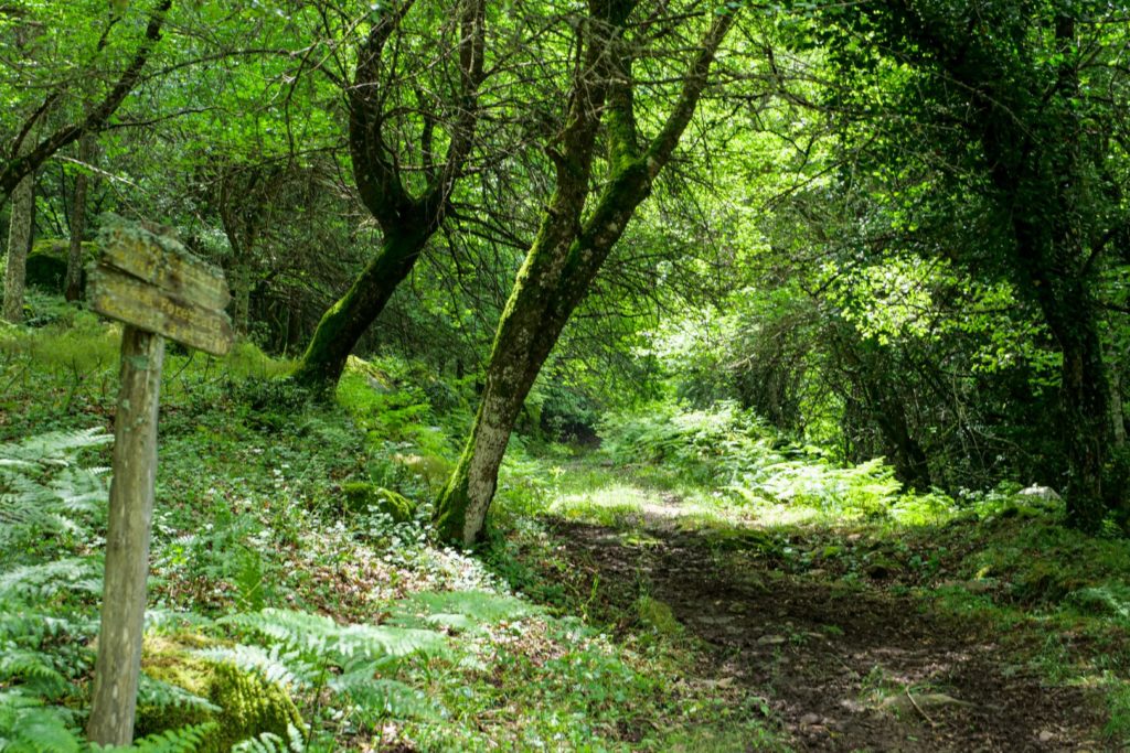
The Reserve > Trails
The trails recommended by the Managing Authority and indicated on the interactive map represent nature trails of special interest that wind through unique, unspoiled environments, distinguished by level of difficulty.
The trails recommended by the Managing Authority and indicated on the interactive map represent nature trails of special interest that wind through unique, unspoiled environments, distinguished by level of difficulty.
Length: 1.56Km; Ascent: 39m; Difficulty: Tourist
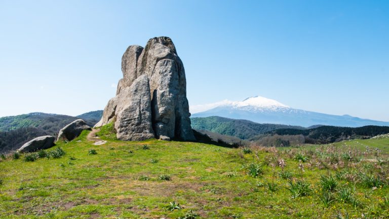
The Megalith Trail moves in a loop through the Argimusco Plateau area, the only example of a megalithic site in Sicily.
Length: 8Km; Ascent: 353m; Difficulty: Hiking
Length: 4.67Km; Ascent: 97m; Difficulty: Hiking
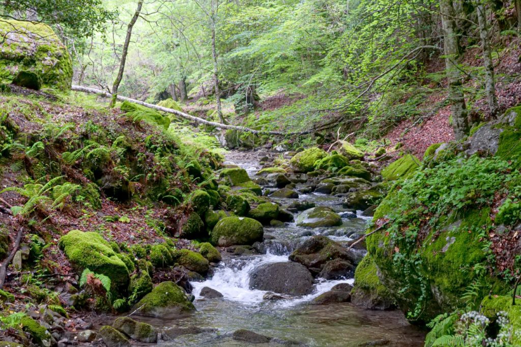
A trail that runs along Licopeti Creek, a watercourse rich in waterfalls that plunges through typical riparian vegetation.
Length: 7.4Km; Ascent: 449m; Difficulty: Hiking
A loop trail that, alternating between ascents and descents, offers a glimpse of the heart of the Reserve.
Length: 5.6Km; Ascent: 217m; Difficulty: Hiking
A long downhill path that runs alongside the Reserve’s ridge until it reaches its end near “Pizzo Galera.”

Length: 2.3Km; Ascent: 52m; Difficulty: Tourist
An easy-going trail that skirts the northern entrance to the Reserve, ideal for a nature walk.
Descrizione – Un sentiero ad anello intorno all’area dell’Altopiano dell’Argimusco, unico esempio di sito megalitico in Sicilia. In questa zona sorgono numerosi elementi rocciosi di arenaria quarzosa modellati in forma curiosa e suggestiva. La tradizione popolare attribuisce questi megaliti all’opera di popolazioni preistoriche. Gli archeologi sono favorevoli piuttosto ad attribuire tale origine ad un’azione naturale, in particolare all’erosione eolica.
Itinerario – Proseguendo da Montalbano Elicona lungo la SP115 in direzione dei “Megaliti dell’Argimusco”, svoltando sulla sinistra ad un centinaio di metri, si accede all’Altopiano dell’Argimusco, punto di ingresso dell’area.
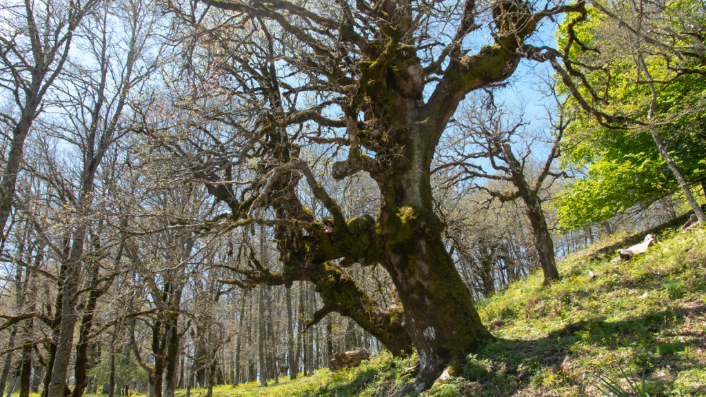
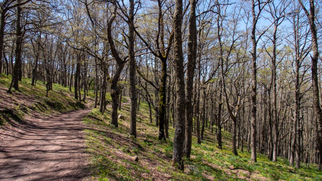
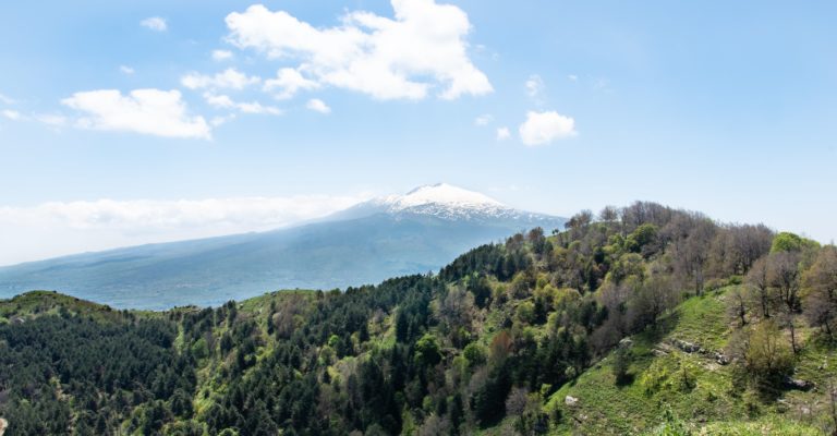
Descrizione – Lungo la dorsale che va da “Monte Cerreto” a “Pizzo Ralo” è possibile ammirare le piante secolari di Querce dalle forme articolate e maestose. La dorsale è anche un luogo ideale per assistere al volo di diversi rapaci. Da qui, oltre a poter ammirare dall’alto i magnifici boschi della Riserva, si aprono panorami suggestivi sull’Etna e su Montagna Grande (m 1374), la cima più elevata della catena Peloritana.
Itinerario – Dal parcheggio Nord della Riserva, si scende a destra per 900 metri attraverso un fitto bosco di Cerro e si giunge alla biforcazione del sentiero ad anello. Proseguendo sulla destra per circa 2,5 Km si raggiunge l’ex caserma forestale, dove è presente un’area attrezzata. Continuando, tra splendide piante di Faggio e Agrifoglio, si risale verso la sommità del Vallone “Ca Devanne”, da dove, deviando a sinistra, si raggiunge la dorsale in prossimità di Serro Faita. Costeggiando le cime più alte: Pizzo Petrolo (m 1338), Rocca Voturi (m 1325), Monte Croce Mancina (m 1341) e Monte Cerreto (m 1288); si possono ammirare le Faggete extrazonali che giungono a oltre 1300 m.s.l.m.
Descrizione – Lungo le vallate è possibile apprezzare il pregevole popolamento di Cerro, mentre lungo le rive si trovano i popolamenti a Pioppo, Ontano, Salici, Aceri, ecc. Nelle limpide acque perenni del Licopeti è facile notare la presenza della Trota endemica.
Itinerario – Il sentiero parte dalle vecchie casette dei carbonai, qualche chilometro prima dalla ex caserma forestale situata al centro della Riserva. Il Sentiero costeggia i piccoli affluenti del “Torrente Licopeti” fino a “Rocca Licopeti”, confine Sud della Riserva che affaccia sulla cittadina di “Roccella Valdemone”. Ulteriori ingressi, accedendo dal lato Nord-Ovest nei pressi di “C.da Croce Piano Notaro” oppure da Sud-Ovest da “Rocca Licopeti”.

Descrizione – Un sentiero ad anello che parte dalla ex caserma forestale. Percorrendo il lato sinistro del sentiero, per un primo tratto è possibile ammirare i boschi di Faggio e Agrifoglio sino alla sommità del “Vallone Ca Devanne”, scendendo lungo il vallone si incontrano piante di Cerro ed arbusti di Citiso, Ginestra e Rosa Canina.
Itinerario – Dal parcheggio Nord della Riserva, continuare per circa 3 Km lungo il sentiero di destra sino a raggiungere l’ex caserma forestale. Partendo da qui, continuare sulla sinistra e proseguire sino al bivio verso la dorsale, da qui svoltare a destra e scendere lungo il “Vallone Ca Devanne”. Proseguendo lungo il sentiero tracciato si raggiunge il “Torrente Fontanazzi”, al bivio svoltare sempre a destra risalendo verso la vecchia caserma forestale, punto di partenza dell’anello.
Descrizione – Lungo questo sentiero è possibile ammirare un complesso boscato di Roverella e formazioni rocciose calcaree tipiche.
Itinerario – Dal parcheggio Nord della Riserva, scendere a destra per 900 metri attraverso un fitto bosco di Cerro e Faggio, proseguire sul lato sinistro verso “Pizzo Vuturi”. Procedendo oltre il territorio della Riserva è possibile congiungersi con la strada provinciale che si collega al centro abitato di Francavilla di Sicilia.
Descrizione – Il sentiero si sviluppa nelle immediate vicinanze dell’ingresso Nord della Riserva ed è particolarmente breve e agevole. Costeggiando Monte Cerreto e Contrada Rindena, termina a Rocca Lepre nel comune di Tripi.
Itinerario – Dal parcheggio Nord della Riserva, scendere a sinistra in direzione del “Demanio Faggita”. Sentiero semplice da percorrere, sempre diritto, sino al confine Nord-Est della Riserva.
La Riserva Naturale Orientata del Bosco di Malabotta è, prima di tutto, una Riserva Naturale protetta, curata ed a tua disposizione tutto l’anno: vivila e rispettala.
Esplora anche:
The Malabotta Forest Oriented Nature Reserve is, first and foremost, a protected Nature Reserve, cared for and available to you all year round: experience it and respect it.
Also explore:
Description – A loop trail around the Argimusco Plateau area, the only example of a megalithic site in Sicily. Numerous rocky elements of quartz sandstone shaped in curious and striking forms arise in this area. Popular tradition attributes these megaliths to the work of prehistoric peoples. Rather, archaeologists favor attributing this origin to natural action, particularly wind erosion.
Itinerary – Continuing from Montalbano Elicona along the SP115 in the direction of the “Argimusco Megaliths,” turning left about a hundred meters, you enter the Argimusco Plateau, the area’s entry point.
Description – Along the ridge from “Monte Cerreto” to “Pizzo Ralo” it is possible to admire centuries-old Oak trees with articulated and majestic forms. The ridge is also a great place to witness the flight of various birds of prey. From here, in addition to being able to admire the magnificent forests of the Reserve from above, there are striking views of Mount Etna and Montagna Grande (m 1374), the highest peak of the Peloritanian chain.
Itinerary – From the North parking lot of the Reserve, descend to the right for 900 meters through a dense Cerro forest and reach the fork of the loop trail. Continue to the right for about 2.5 km to reach the former forestry barracks, where there is a picnic area. Continuing, among beautiful Beech and Holly trees, we climb to the top of the “Ca Devanne” valley, from where, deviating to the left, we reach the ridge near Serro Faita. Skirting the highest peaks: Pizzo Petrolo (m 1338), Rocca Voturi (m 1325), Monte Croce Mancina (m 1341) and Monte Cerreto (m 1288); one can admire the extrazonal Beech forests that reach over 1300 m.a.s.l.
Description – Along the valleys it is possible to appreciate the valuable stand of Turkey oak, while along the banks are stands of poplar, alder, willows, maples, etc. In the clear perennial waters of the Licopeti it is easy to notice the presence of the endemic Trout.
Route – The trail starts from the old charcoal makers’ cottages, a few kilometers before the former forestry barracks located in the center of the Reserve. The Trail runs along the small tributaries of the “Licopeti Stream” to “Rocca Licopeti,” southern border of the Reserve overlooking the town of “Roccella Valdemone.” Additional entrances, accessing from the Northwest side near “C.da Croce Piano Notaro” or from the Southwest from “Rocca Licopeti”.
Description – A loop trail starting from the former forestry barracks. Walking along the left side of the trail, for a first part it is possible to admire the Beech and Holly woods until the top of the “Vallone Ca Devanne,” descending along the valley we encounter Cerro plants and shrubs of Citiso, Broom and Rosehip.
Itinerary – From the North parking lot of the Reserve, continue for about 3 km along the right trail until you reach the former forestry barracks. Starting here, continue on the left and continue until the fork to the ridge, from here turn right and descend along the “Vallone Ca Devanne.” Continuing along the marked path you reach the “Fontanazzi Stream,” at the fork turn right again going up to the old forestry barracks, the starting point of the loop.
Description – Along this trail you can see a wooded complex of Downy Oak and typical limestone rock formations.
Route – From the North parking lot of the Reserve, descend to the right for 900 meters through a dense Cerro and Beech forest, continue on the left side towards “Pizzo Vuturi.” Proceeding beyond the territory of the Reserve it is possible to join the provincial road that connects to the town of Francavilla di Sicilia.
Description – The trail runs in the immediate vicinity of the northern entrance to the Reserve and is particularly short and easy. Skirting Monte Cerreto and Contrada Rindena, it ends at Rocca Lepre in the municipality of Tripi.
Route – From the North parking lot of the Reserve, descend to the left in the direction of the “Demanio Faggita”. Easy trail to walk, straight ahead, to the northeastern border of the Reserve.